Nigeria's ocean data system is outdated, and the country needs to fix it fast — or risk losing out on the massive economic potential of its waters.
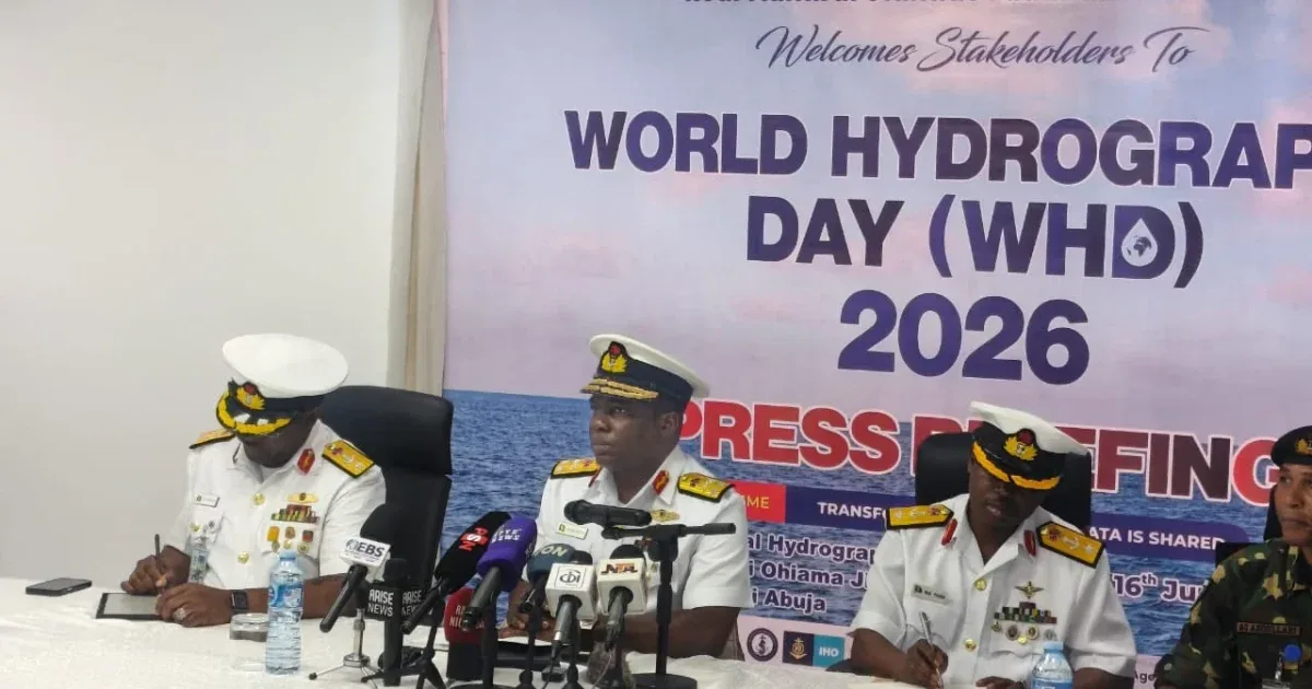
That warning came from the Hydrographer of the Federation, Rear Admiral Olumide Fadahunsi, on Tuesday in Abuja. He spoke at a press briefing to mark the 2026 World Hydrography Day, which the International Hydrographic Organisation (IHO) celebrates globally on June 21.
"Hydrography remains the bedrock of maritime safety, ocean governance and environmental protection," Fadahunsi said. "Accurate charts and ocean-data products derived from modern surveys are essential for safe navigation, port development, offshore energy, submarine cable and pipeline routing, fisheries management and coastal-resilience planning."
Fadahunsi, who also runs the National Hydrographic Agency (NHA), said Nigeria will formally mark the day on June 20 in Lagos. The theme this year is deliberately written in plain language — not technical jargon — so everyone from policymakers to the general public can engage with it.
The centrepiece of Nigeria's celebration will be a plenary session on June 20. Fadahunsi said it will bring together subject-matter experts, researchers, policy leaders, hydrographic authorities, industry partners and development agencies. They'll discuss how better ocean-data sharing can strengthen navigation safety, maritime administration and Blue Economy growth in Nigeria and across Africa.
"By transforming how ocean data is organised, standardised and shared, especially through S-100-compliant services, Nigeria can reduce navigational risk, support efficient maritime trade and contribute to regional and global efforts to keep sea lanes safe," Fadahunsi added.
S-100 is a modern data standard developed by the IHO. It allows different types of marine data — like electronic navigational charts (S-101) and seafloor depth maps (S-102) — to be shared seamlessly. The International Maritime Organisation has already approved S-100-based ECDIS (Electronic Chart Display and Information System) as the standard for navigation in international shipping.
Fadahunsi said the plenary session is expected to produce concrete outcomes. These include better national and regional understanding of why ocean data sharing matters, stronger collaboration among hydrographic offices, maritime authorities, academic institutions, regulators and private-sector actors, and practical recommendations for making ocean data more accessible and interoperable.
Nigeria's celebration also aligns with the United Nations Sustainable Development Goal 14 (Life Below Water) and the UN Decade of Ocean Science for Sustainable Development (2021–2030).
World Hydrography Day was established by the IHO to raise awareness of hydrography — the science of measuring and describing the physical features of oceans, seas, coastal areas, lakes and rivers. The IHO, which coordinates hydrographic surveying standards among its 98 member states, picks a fresh theme each year.
The National Hydrographic Agency was created to produce nautical charts and manage ocean data for Nigeria's 853-kilometre coastline. The country's waters are among the busiest in West Africa, with major ports in Lagos, Port Harcourt, Warri and Calabar handling billions of dollars in trade annually. Poor charts have been linked to groundings and accidents in the past.
Fadahunsi urged the media to highlight the NHA's role in implementing modern hydrographic standards and partnering with regional and international organisations to transform how ocean data is shared for safety, security and sustainable development.