

If you live along the coast of Sarangani Peninsula and suddenly noticed the shoreline has moved farther away, you're not imagining things. The ground literally rose.
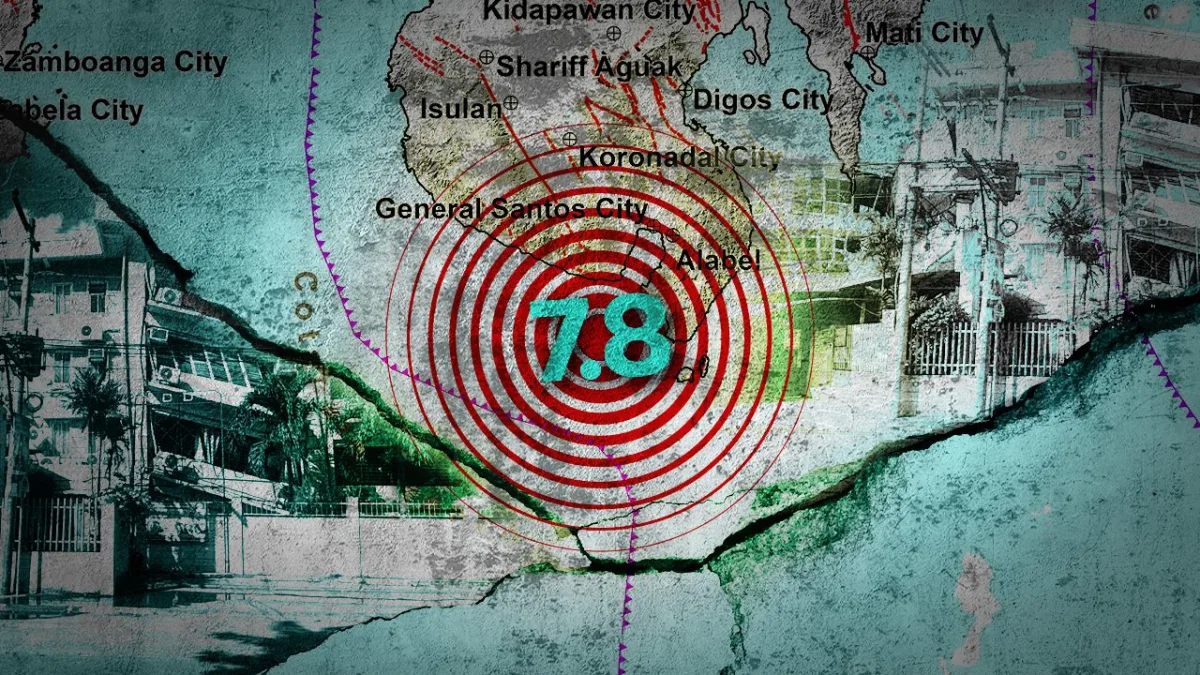
Since the magnitude 7.8 earthquake struck offshore south of the peninsula on June 8, 2026, residents in towns like Glan and Jose Abad Santos have seen parts of the seabed now exposed as dry land. Social media lit up with questions: Is this normal? Could the water come rushing back as a tsunami?
Here's the science behind it, explained simply.
The earthquake was caused by a thrust fault — a crack in the Earth's crust where one block of rock slides up over another. Think of a car driving up a ramp onto a trailer truck: the car is thrust upward. That's exactly what happened to the ground above the fault.
In this case, the fault is part of the Cotabato subduction zone, where the Cotabato Trench — one of five trenches surrounding Mindanao — is located. The other four are the Sulu, Philippine, Sangihe, and Halmahera trenches.
When a subduction trench produces a big enough earthquake, the crust above the inclined fault gets pushed upward. This is called coastal uplift. Scientists can measure it using satellite images and ground surveys. The Philippine Institute of Volcanology and Seismology (Phivolcs) confirmed the earthquake came from the Cotabato subduction zone.
Preliminary interferometric analysis — a technique where satellites compare images taken at different times to detect ground movement — showed maximum uplift in Glan, Sarangani province, and Jose Abad Santos, Davao Occidental. Onsite verification found uplift in villages like Pangyan, Burias, Big Margus, Small Margus, and Batulaki in Glan; and Kitayo, Bukid, and Camalian in Jose Abad Santos.
So what does this mean for the people living there? The most common worry is whether the exposed seabed means a tsunami is coming. Phivolcs and other experts say no. Coastal uplift from a thrust fault actually reduces tsunami risk because the seafloor rises, displacing less water. The real danger for tsunamis comes from vertical displacement that pushes water upward — not the kind of uplift seen here.
Still, the recession of the shoreline can be alarming. Some netizen posts have spread confusing or alarming messages. Phivolcs has put out official explanations, but misinformation continues to circulate.
For now, the ground in those coastal barangays is higher than it was before June 8. The shoreline has changed. Fishermen may find their usual landing spots are now several meters inland. But the sea isn't coming back in a destructive wave — at least not because of this uplift.
"When uplift occurs along a coast, what was once seabed submerged underwater may rise and be exposed to the surface," Phivolcs explained in its official posts.
That's exactly what happened. The ground rose, the water receded, and the coast is now different. It's a dramatic reminder that the Earth is alive — and in the Philippines, it's always moving.